Nearby Villages
(click on symbol to see the village page) |
| Village= | |
Town= | |
Recorded in Domesday= |  |
|
|
|
|
Ashurst |
(Miraculous Carving) | | 2.54 miles |
|
|
Bells Yew Green |
(The ruins of Bayham Abbey) | | 4.14 miles |
|
|
Blackham |
(Roughs and Prize Fighters) | | 3.07 miles |
|
|
Chiddingstone |
(A perfect Tudor village) | | 4.83 miles |
|
|
Colemans Hatch |
(Church on the edge of the forest) | | 7.08 miles |
|
|
Eridge Green |
(The home of the Neville Family) | | 2.27 miles |
|
|
Fordcombe |
(Paper Mill and the Field Marshal) | | 1.58 miles |
|
|
Frant |
(King Johns hunting lodge) | | 3.45 miles |
|
|
Groombridge |
(Home of the Groombridge Gang) | | 1.75 miles |
|
|
Hartfield |
(A.A.Milne and Winnie-the-Pooh) | | 4.89 miles |
|
|
Hever |
(Anne Boleyn and the Castle) | | 5.89 miles |
|
|
Matfield |
(Largest Village Green in Kent) | | 6.78 miles |
|
|
Pembury |
(The ghost of Hawkwell) | | 5.14 miles |
|
|
Rusthall |
(The Toad Rock) | | 0.77 miles |
|
|
Speldhurst |
(Nobleman captured at Agincourt) | | 1.39 miles |
|
|
Tudeley and Capel |
(Iron Industry and Hop Pickers) | | 6.39 miles |
|
|
Withyham |
(De La Warrs and Sackvilles) | | 4.04 miles |


 Langton Green in Kent lies on the A Tunbridge Wells to East Grinstead road,
between
Langton Green in Kent lies on the A Tunbridge Wells to East Grinstead road,
between 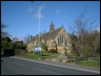 Langton Green in Kent has some nice lanes surrounding the green.
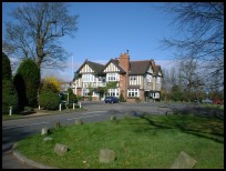
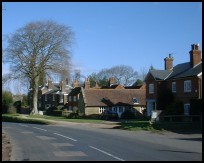 Langton Green in Kent has a few local village shops , a petrol station
a public house and the church.
Langton Green in Kent has a few local village shops , a petrol station
a public house and the church.


